 The Ursern Valley is a high valley in the headwaters of the Reuss and is located in the southern part of the Canton of Uri. At an altitude of around 1,500 m above sea level, it extends in an east-west direction. In the north, the valley is bordered by the jagged ridges of the Aar massif; in the south by the Gotthard massif. The Ursern Valley is a glacial U-shaped valley with pronounced trough shoulders, steep valley flanks and a flat valley floor.
The central location and the mountain crossings in all directions have shaped life in the valley. The international pass traffic via the Gotthard, Furka and Oberalp is still important for the economy in the high valley today. However, Alpine farming and agriculture were also always important.
The area forms a weather divide with a harsh climate. The high valley is subject to the influence of winds from the west as well as from the south and therefore has a high level of precipitation.
Due to the altitude, the vegetation period only lasts three to four months. Where there is little sunshine, the snow stays on the ground for a long time in spring and also shortens the vegetation period.

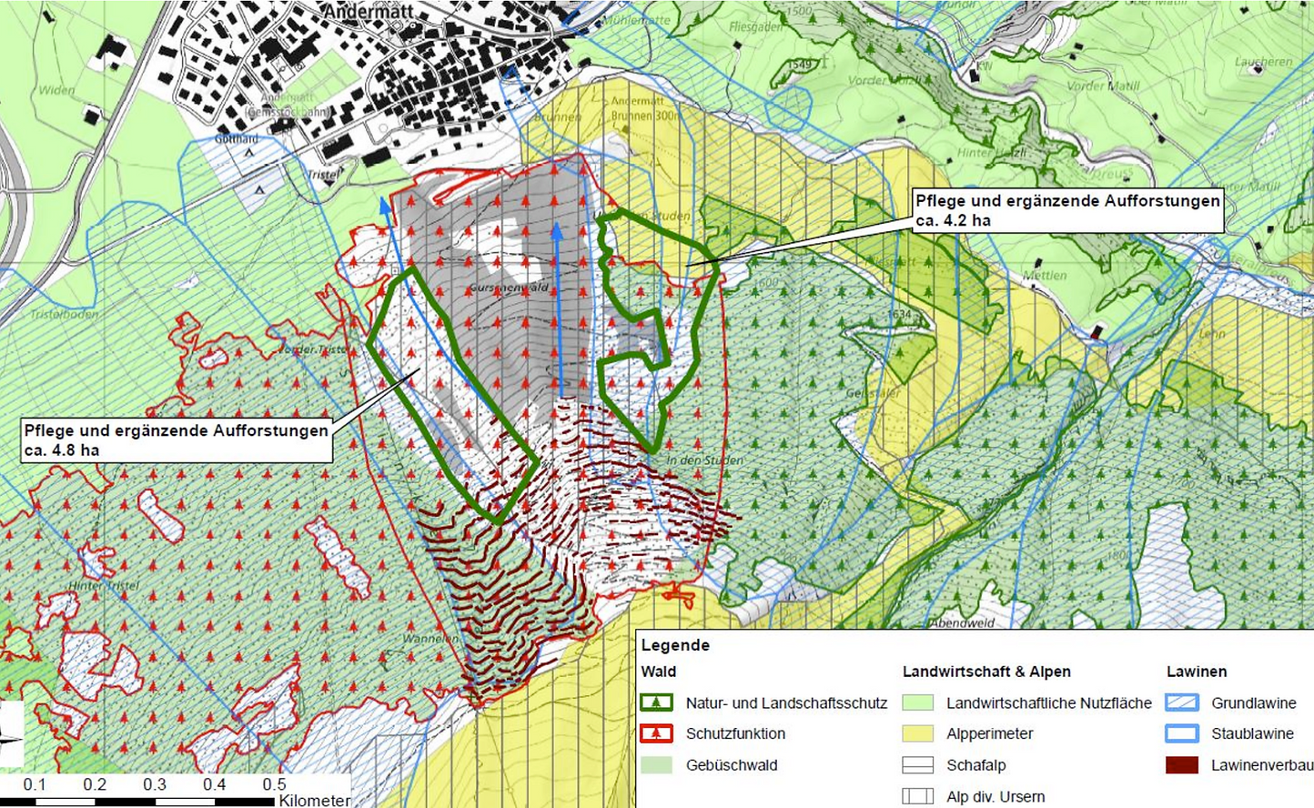
Gurschenwald
Community Andermatt
9 ha
48,600 saplings
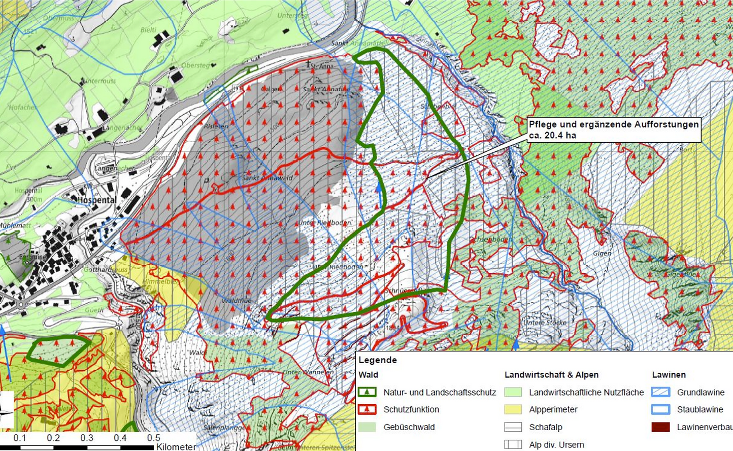
Riedboden
Community Hospental
20.4 ha
Supplementary afforestation
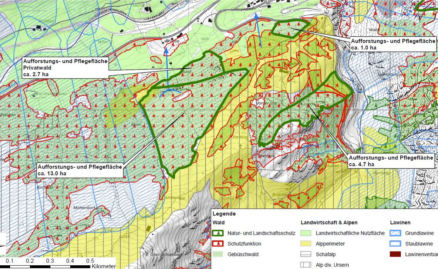
Mussli-Gsang
Community Hospental
21.4 ha
64,200 saplings
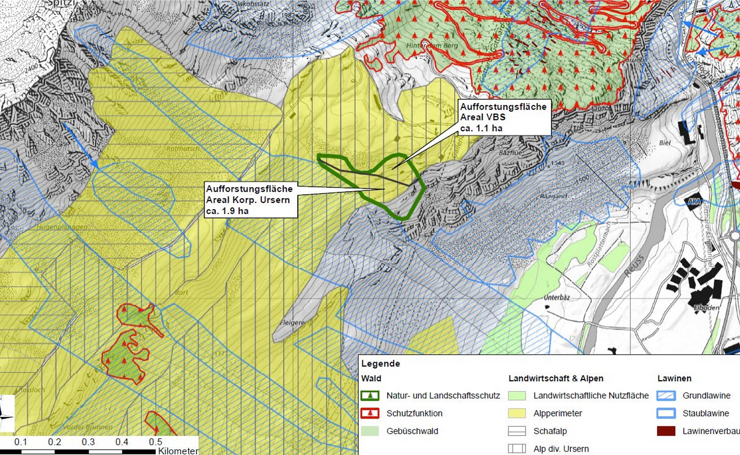
Bäz
Community Andermatt
3 ha
9,000 saplings
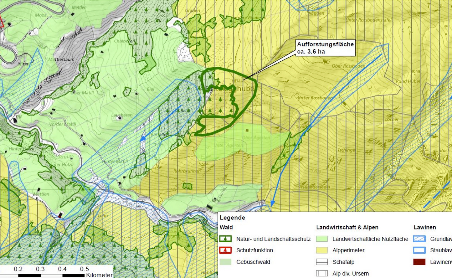
Sattelegg
Community Andermatt
3.6 ha
27,000 saplings
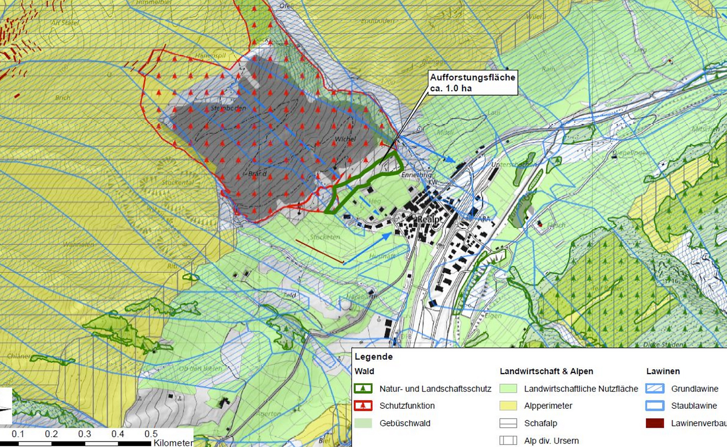
Bannwald Realp
Community Realp
1 ha
4,000 saplings